ExpertGPS 9.19 Full Description
ExpertGPS, developed by TopoGrafix, is a robust and versatile GPS mapping software designed to cater to the needs of outdoor enthusiasts, professional surveyors, and GIS specialists alike. This comprehensive tool seamlessly integrates with a wide range of GPS devices, providing users with the ability to plan, manage, and analyze their outdoor adventures or professional projects with precision and ease.
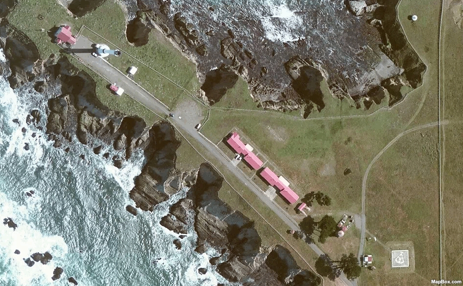
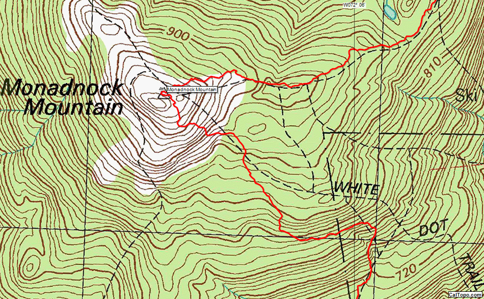
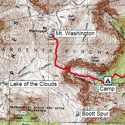
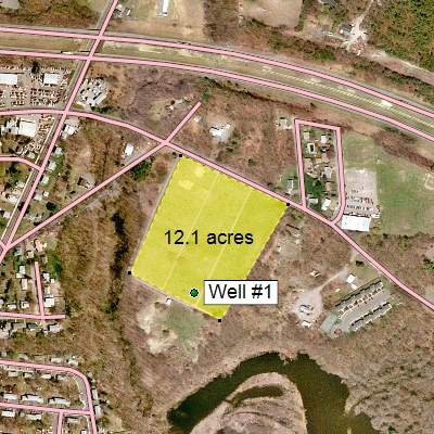
One of the standout features of ExpertGPS is its extensive map library. Users have access to high-resolution aerial imagery, topographic maps, and street maps, ensuring they have the most accurate and up-to-date information at their fingertips. The software supports both USGS topo maps and seamless aerial photos, which can be invaluable for detailed planning and navigation.
ExpertGPS excels in its ability to handle waypoints, routes, and tracks. Users can effortlessly import and export data between their GPS devices and the software, making it simple to plan trips, mark points of interest, and track movements. The software's intuitive interface allows for easy editing and management of this data, ensuring that users can customize their maps to suit their specific needs.
For professionals, ExpertGPS offers powerful GIS capabilities. The software supports a wide range of file formats, including GPX, KML, and SHP, making it easy to integrate with other GIS tools and datasets. Users can perform complex spatial analysis, create detailed maps, and generate reports with ease. The ability to overlay different types of data, such as property boundaries or environmental features, makes ExpertGPS an invaluable tool for surveyors, environmental scientists, and urban planners.
Another notable feature is the software's robust geocoding and reverse geocoding capabilities. Users can quickly convert addresses to GPS coordinates and vice versa, streamlining the process of locating and documenting points of interest. This functionality is particularly useful for fieldwork and data collection, where accuracy and efficiency are paramount.
ExpertGPS also offers a range of customization options, allowing users to tailor the software to their specific needs. From customizing map symbols and labels to creating personalized templates for data collection, the software provides the flexibility required for both casual users and professionals.
In terms of usability, ExpertGPS boasts a user-friendly interface that is both intuitive and powerful. The software is designed to be accessible to users of all skill levels, with comprehensive help resources and tutorials available to assist with any questions or challenges that may arise.
In summary, ExpertGPS by TopoGrafix is a feature-rich, versatile, and user-friendly GPS mapping software that caters to a wide range of users. Whether you're an outdoor enthusiast planning your next adventure, a surveyor conducting fieldwork, or a GIS specialist performing complex spatial analysis, ExpertGPS provides the tools and capabilities you need to succeed. Its extensive map library, robust data management features, and powerful GIS capabilities make it a standout choice in the world of GPS mapping software.
Release notes:
New Release
Updated to latest version of ESRI FileGeodatabase API.
Fixed Garmin Alpha 300i to use MTP mode.
Added new Wyoming Lambert projection.
Improved GeoTIFF import.
Added projection information to the list of maps in the Scanned Map Library.
Modified the Edit Scanned Map dialog to show the current projection as well as options for entering custom projection information.
Fixed error message when closing a scanned map that failed to load.
Added support for KSA GRF17 UTM zones in File Geodatabases.
Added a progress bar when reading large .usr files.
Fixed a recent error when using Remove Track Gaps command on closed tracks.
Fixed an issue with data cells containing commas and quotes (like Symbol "Pin, Green") not being recognized correctly in the Import Text dialog.
Fixed an error that created unusable M (Measure) values when creating PolylineZ shapefiles from certain tracks.
Fixed an error when reading elevation data from the Z value in certain PolylineZ shapefiles.
[
ExpertGPS full changelog ]
ExpertGPS 9.19 Free Download Notice
Top 4 Download periodically updates software information of ExpertGPS 9.19 full version from the publisher,
but some information may be slightly out-of-date.
Using warez version, crack, warez passwords, patches, serial numbers, registration codes, key generator, pirate key, keymaker or keygen for
ExpertGPS 9.19 license key is illegal and prevent future development of
ExpertGPS 9.19. Download links are directly from our mirrors or publisher's website,
ExpertGPS 9.19 torrent files or shared files from free file sharing and free upload services,
including Rapidshare, HellShare, HotFile, FileServe, MegaUpload, YouSendIt, SendSpace, DepositFiles, Letitbit, MailBigFile, DropSend, MediaMax, LeapFile, zUpload, MyOtherDrive, DivShare or
MediaFire,
are not allowed!
Your computer will be at risk getting infected with spyware, adware, viruses, worms, trojan horses, dialers, etc
while you are searching and browsing these illegal sites which distribute a so called keygen, key generator, pirate key, serial number, warez full version or crack for
ExpertGPS 9.19 download. These infections might corrupt your computer installation or breach your privacy.
A keygen or key generator might contain a trojan horse opening a backdoor on your computer.
Hackers can use this backdoor to take control of your computer, copy data from your computer or to use your computer to distribute viruses and spam to other people.